
| HABYTIME MINI LECTURE 51: OVERWEIGHT CAPE
| |||||||||||||||||||||||||||||||||||||||||||||||||||||||||||||||||||||||||||||||||||||||||||||||||||||||||||||||||||||||||||||||||||||||||||||||||||||||||||||||||||||||||||||||||||||||||||||||||||||||||||||||||||||||||||||||||||||||||||||||||||||||||||||||||||||||||||||||||||||||||||||||||||||||||||||||||||||||||||||||||||||||||||||||||||||||||||||||||||||||||||||||||||||||||||||||||||||||||||||||||||||||||||||||||||||||||||||||||||||||||||||||||||||||||||||||||||||||||||||||||||||||||||||||||||||||||||||||||||||||||||||||||||||||||||||||||||||||||||||||||||||||||||||||||||||||||||||||||||||||||||||||||||||||||||||||||||||||||||||||||||||||||
METEOROLOGIST JEFF HABY
CAPE is a measure of instability in the troposphere. Higher values of CAPE can lead to stronger updrafts. This writing focuses on the
ingredients that can lead to huge values of CAPE. There are several factors that need to combine together to produce a huge amount of
CAPE. These include cold air aloft, very warm air in the boundary layer, a LFC (Level of Free Convection) close to the surface and high
dewpoints in the boundary layer. It helps to also have a rapid transition from the very warm air in the boundary layer to the very
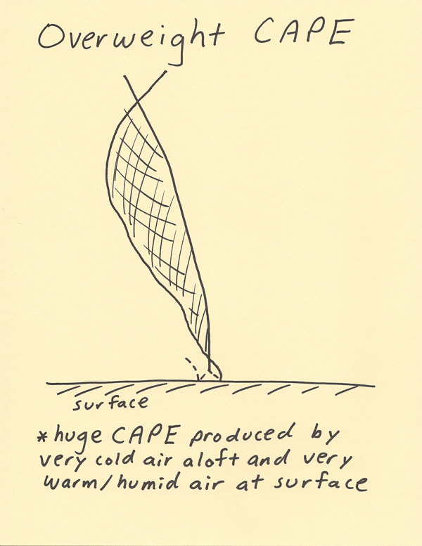
cold air aloft. This will maximize the depth in which the parcel temperature is much warmer than the temperature sounding. In the
diagram below the parcel sounding is to the right of the temperature sounding within a huge depth of the troposphere. A very warm
and saturated boundary layer will allow a rising parcel of air to rise at the wet adiabatic lapse rate and this contributes to the
parcel being warmer than the environmental temperature since rising saturated air cools off more slowly than rising unsaturated air.
A LFC close to the ground indicates a boundary layer that is near saturation. In a differential advection situation, cold air can
move into the middle levels of the atmosphere while warm tropical humid air moves into the boundary layer. This contrast
in temperature helps lead to huge CAPE values. When all these factors combine together (high boundary layer dewpoint, saturated boundary
layer air, very warm boundary layer air, advection of cold air into the middle levels, a rapid temperature decrease with height), then
extreme values of CAPE can be produced. This overweight CAPE can be in the many 1000’s of Joules per kilogram. This sort of energy can
lead to explosive updrafts and severe weather. A good place to look for overweight CAPE is in the U.S. plains in the spring season.
|
|
|