
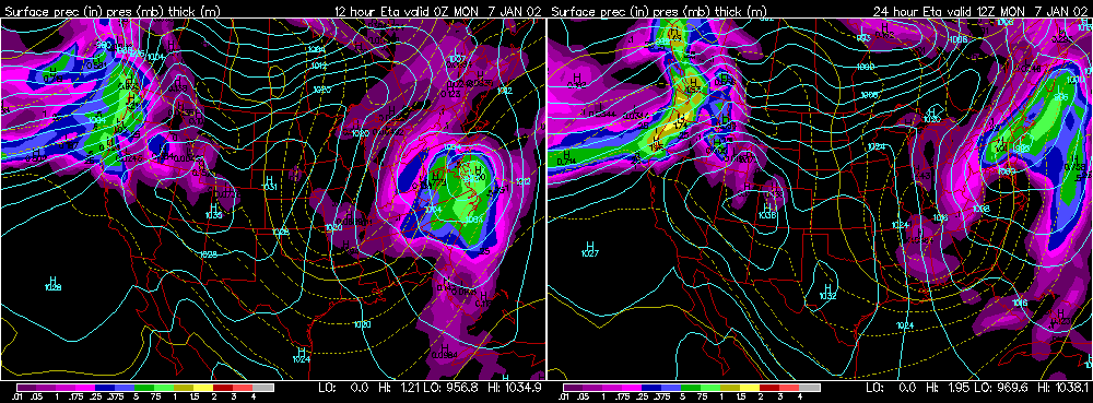
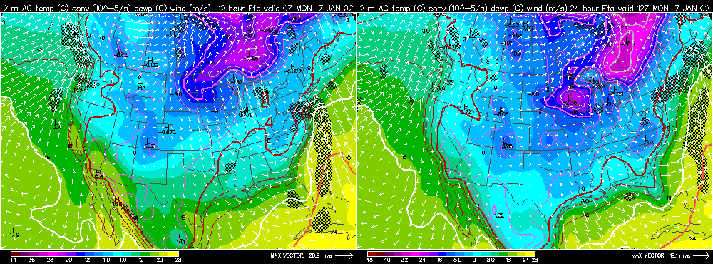
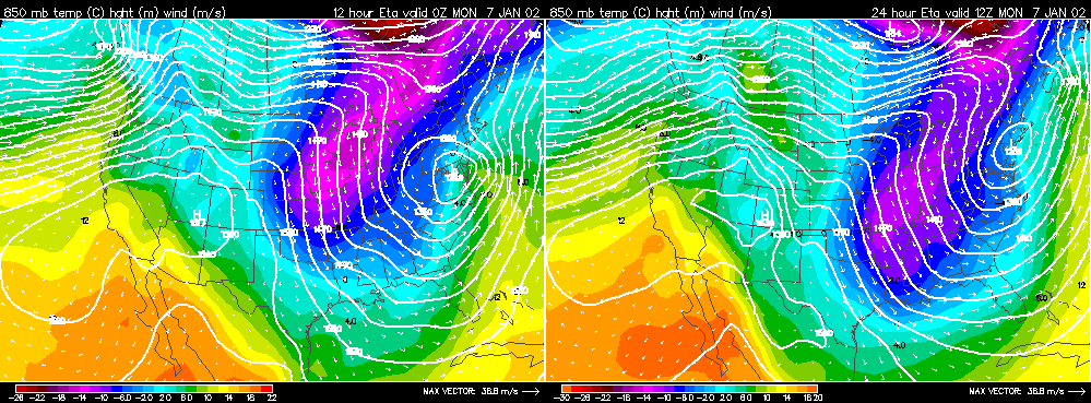
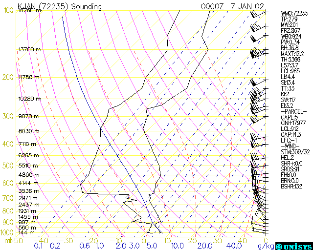
The 1000 to 500 millibar thickness represents the distance between the 1000 and 500 mb pressure levels and is primarily a function of the average temperature between 1000 and 500 mb. The 540 line (5,400 gpm) is often used to approximate the rain/snow line. In general, the 540 line represents a 50/50 chance that precipitation, if it does occur, will be snow. When looking at the temperature profile of the troposphere, it can often be determined that the chance that precipitation will be snow is much greater or much less than 50%. In the situation studied here, the chance for snow is less than 50%. Cold thickness biasing occurs when the 540 line is overhead (or thickness is less than 540) but it can be determined from investigated further data that the chance for snow is less than 50% if precipitation occurs. We will look at a case study for northern Mississippi. The panel below has represented the 540 thickness line in the period from 0 Z to 12 Z. At 0 Z the 540 line runs through central MS and at 12 Z it runs through southern MS. Notice the thicknesses in northern MS are less than 540 (534 and 528). In a general situation, snow would be expected in northern MS but it was not the case in this example. Thickness panel The panel below shows the 2-m above ground temperature. Notice at 0 Z the temperatures in northern MS range from 4 to 8 C and at 12 Z the temperature range from 0 to 4 C. In this case, the lower troposphere was too warm to support snow. A band of rain moved through the state between 3 and 6 Z. The precipitation fell as snow aloft but melted before reaching the surface. Surface panel Why were thicknesses so low when the lower troposphere was above freezing? To answer this question we will examine the 850 mb panel below. Notice that between 0 Z and 12 Z the temperatures were well below freezing across northern Mississippi at 850 mb. The cold air aloft led to a reduction in thickness. This is a situation where CAA increased with height. Strong winds associated with a northwesterly flow brought much colder air into the mid-levels. 850 mb panel The sounding from JAN below gives evidence of the strong CAA in the mid-levels. Notice a strong northwesterly flow between 850 and 600 mb and also notice a high lapse rate of cooling with height between 850 and 700 mb. The thick layer of cold air aloft carries more weight than the shallow layer of warmer air in the lower PBL, thus the 1000-500 mb thickness is 540 and below even though the surface is well above freezing. Jackson, MS Skew-T |