
METEOROLOGIST JEFF HABY
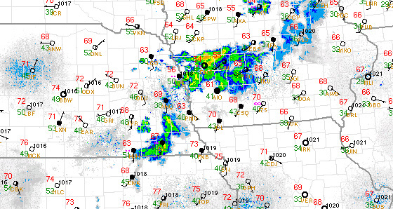
Each surface station plot has a circle in the middle. This is used for both identifying the location of the station and identifying cloud
cover information. An open circle that is not darkened indicates clear skies. In the example below, clear skies at some stations can be seen
toward the east and west of the region of precipitation. Cloudy skies are indicated by a full darkening of the circle. This is also called
overcast conditions. Several overcast station plots can be seen within and near the region of precipitation in the example. The amount
of cloud coverage determines how much of the station plot is shaded. Partly cloudy skies (also called partly sunny) is typically shaded
by half. Fair conditions (also called mostly sunny) will have 1/4th of the station plot shaded. Mostly cloudy skies (also called broken)
will have 3/4ths of the station plot shaded. If the sky condition can not be seen such as from smoke, dust, or smog, typically the
station plot will have an x over the circle to indicate an obscured sky. There are limitations to this type of plotting. One is
that it does not show the type of clouds and elevation of clouds. Cloud cover amount can also change rapidly over a few minutes
at any one point. Satellite images can be examined to supplement the station plot information to get a better idea of cloud coverage,
cloud type and cloud height.
|
|
|