
Radar monitoring is studying the current weather radar. A network of radars makes it possible to study precipitation, storm development and storm propagation across large areas. Radar monitoring is especially effective over land where radar systems overlap with each other. This makes it possible to monitor real time radar conditions over a vast geography. The image below is an example of a composite radar image over a geographical region of several states. Typically of most interest is the radar display for the local area. During a storm event, it is common to have real time radar constantly in view in order to monitor new precipitation develop, the movement of storms and the potential severity of storms. Radar is a valuable tool for issuing tornado and severe storm warnings since it can be used to infer hail size, intensity of precipitation, wind motion within a storm and mesocyclonic circulation. During big weather events that are unfolding, radar is typically monitored exponentially higher than on a typical weather day. A focus of this writing concerns potential pitfalls that can occur when monitoring radar data. These foci are given below: 1) It can be easy to miss new development. Convective precipitation occurs very quickly. A storm can go from just developing to severe in the matter of minutes. It can be easy to get fixated on severe storms that have already developed. With so much focus on these storms, new storms can be missed if the entire radar display is not continuously monitored. This can result in a missed opportunity to inform about the threat from newly developing storms. 2) It is important to have up to date images. After a few minutes, a storm will move to a new position and possibly have different storm characteristics. It is important that the images be as close to real time as possible. Using data that is relatively old can result in missed opportunities to inform about what storms are doing NOW. 3) Many radar displays only show one horizontal slice of a storm. One slice can miss what is going on above and below this slice. This is especially true for storms very close and far from the radar site. Thus, it is important to examine multiple slices of a storm. This will make it more likely that the storm can be correctly assessed for particular severe weather threats. 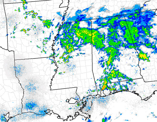 |