
METEOROLOGIST JEFF HABY
An isobar is a contour of constant pressure. Pressure is produced by the weight of the air (influenced by mass, depth of air and gravity)
above a fixed point and normalized to sea level so that land elevation does not influence comparing locations. Each contour is labeled
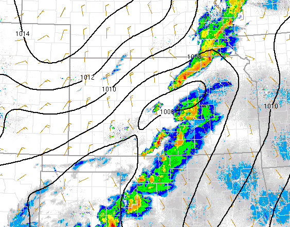
with a specific value. For example, on the image below note the 1008 millibar contour. On one side of this contour the pressure will
be higher than 1008 millibars and on the other side the pressure will be less than 1008 millibars. The region between the 1008 and
1010 millibar contours will have a pressure between these two values. Contours are drawn so that patterns in the data can be instantly
recognizable. The isobar contours show regions of relatively lower pressure and relatively higher pressure. The image below shows
a region of relatively lower pressure over Kansas. Due to surface friction, the wind will cross the isobars toward lower pressure. Notice
the convergence or how the wind vectors approach each other across central Kansas. This convergence helps promote uplift that
in this case produced storms.
|
|
|