
A microburst is a localized downdraft of air from a thunderstorm. They are important to forecast since they can be very dangerous to aircraft. They can also produce significant wind damage at the surface. In the case of a dry microburst, the precipitation evaporates aloft within the downdraft thus strong straight line wind can be experienced at the surface but with the absence of precipitation. The diagram below shows a microburst originating from a thunderstorm. The downdraft of air accelerates toward the surface since it is denser than the surrounding air. Evaporative cooling within the parcel of air aloft helps the air to become denser. A dry microburst is more likely to happen with high based thunderstorms and when the PBL is dry since there is more time for the precipitation to evaporate and the dry air increases the evaporation rate. The diagram below shows a progression of a dry microburst. At cloud level the downdraft with rain is falling from the storm. In the next diagram it is falling to the surface. In the last diagram the downdraft is splashing to the surface. From the time the downdraft falls from the storm and reaches the surface the precipitation evaporates. 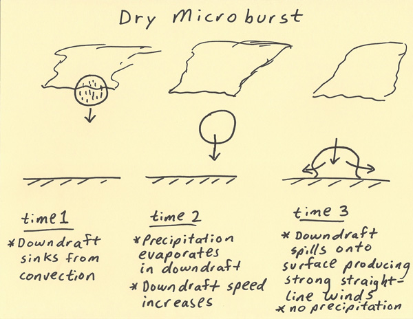 |