
METEOROLOGIST JEFF HABY
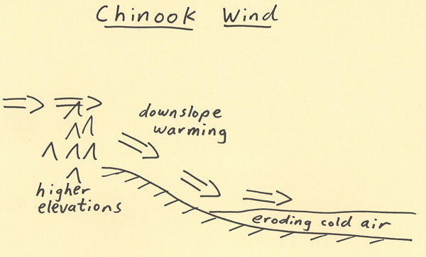
A Chinook wind is a warm and dry wind produced by lee-side wind flow from a high elevation region. In the diagram below the mountains
of high elevation are on the west side of the diagram. The elevation decreases when moving toward the east. In a stable wind flow, the
air will sink into the lower elevations as it moves toward the east. Sinking air warm adiabatically and the relative humidity decreases. Chinook
winds can produce a remarkable temperature increase and relative humidity decrease. This is a reason Chinooks that occur over snowy
terrains are known as “snow eaters”. The warm and dry air promotes rapid melting and evaporation of the snow on the ground. As the
warmer and dry air moves toward the east on the diagram it erodes the layer of cold air at the surface. Cold air is dense and thus
tends to stay closer to the ground. As the warmer air advects over the colder air it mixes the colder air out. Thus, the cold air retreats
as the strong Chinook winds blow from the higher elevations. Chinooks can bring a welcome relief from extremely cold air in the winter.
|
|
|