
Rising air cools. Even when the air at the surface is hot and very humid, when that air is lifted high enough it will have very cold temperatures with ice. A thunderstorm consists of an updraft and a downdraft. The updraft air typically originates from near the surface. The air in the updraft will be less dense than the surrounding air and thus it aggressively rises like a helium balloon let go into the air. As the saturated air rises, it condenses out moisture. When temperatures are above freezing, rain will be condensed out of the air. When temperatures are at or below freezing, supercooled water or ice can result from the vapor moisture removed from the air. When viewing a thunderstorm, during maturity it can be noticed that the bottom portions of the storm have a very different appearance as compared to the top of the storm. At the top portions of the storm the clouds can look wispy, whiter, smooth and spread out. This top frozen portion of the storm is known as the glaciated portion of the storm. Wind speeds tend to be higher aloft and thus the wind will interact with the ice to cause it to fan out and flow away from where the position of the parent thunderstorm is. The diagram below shows where the glaciated portion of a thunderstorm is located. The name for the ice blown downwind from the storm is called an anvil. When a storm is just developing, the entire development will typically consist of all liquid water. As the updraft builds though it can be noticed that the top of the updraft changes appearance as it continues to cool adiabatically as the air rises. When the liquid moisture starts freezing out into ice it can be heard that the thunderstorm… is undergoing glaciation! 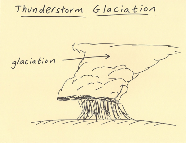 |