
In the diagram below are several of the most common current conditions. Specific locations may have more current conditions that are specific for the area (i.e. ski conditions, lake conditions, boating conditions, aurora, flying weather). Each of the most common current conditions are defined and explained below: Temperature: Current air temperature, typically recorded in Fahrenheit in the U.S. and Celsius elsewhere Dewpoint: The current temperature air needs to be cooled in order for condensation or saturated conditions to take place. When the dewpoint is equal to the temperature then the relative humidity is 100%. Dewpoint helps get a sense of how close the air is to saturation. Humidity: This is in reference to the relative humidity and it is expressed in a percentage. It is the percent that the air is saturated. For example, if the air has half the moisture it could have for a given temperature then the relative humidity is 50%. Dry conditions typically have a relative humidity of below 30%. Saturated conditions have a relative humidity of 100% Sunrise/Sunset: Times for the moment the sun’s disk first becomes visible (sunrise) and the time when the disk is no longer visible (sunset). These times vary with season, topography, latitude, time zone, etc.. Wind: Typically given as the wind speed (miles per hour in the U.S.) and the direction the wind is coming from. Visibility: Restrictions to visibility may also be given such as fog, smoke, precipitation, dust and smog. Visibility is often given in units of fraction of a mile in the U.S. Pressure: This is the barometric pressure standardized to sea level. Rapid changes in air pressure can indicate changes to the weather thus whether the barometer is rising or falling over the past 3 hours or another time range may also be given. Sky Condition: This can include cloud information and the fraction of cloud to entire sky. Common terms include Sunny, Fair, Mostly Sunny, Partly Cloudy, Partly Sunny, Mostly Cloudy, and Overcast 0/10 clear / sunny 1/10 fair (often saved for high wispy cirrus) 2/10 to 3/10 mostly sunny 4/10 to 6/10 partly cloudy 7/10 to 8/10 mostly cloudy 9/10 broken 10/10 cloudy / overcast Weather: Precipitation type will be given. This might also include intensity information such as light and heavy UV Index: This includes information about the dangers of exposure to the sun to exposed skin. Prolonged exposure can produce sun burn. Heat Index / Wind Chill: It may also be given under terms such as “real feel”. The heat index is the apparent temperature from combining humidity and temperature information. The wind chill index is the apparent temperature from combining wind and temperature information. These are not real temperatures but rather are an indication of the rate of heat loss in the case of wind chill and the ability to not lose as much heat in the case of heat index. Moon Phase: Full Moon: entire disk visible from reflected sun light New Moon: basically none of the disk visible from direct reflected sun light Crescent Moon: A sliver to less than 1/4th of the moon visible from reflected sun light Quarter Moon: about 1/4th of the moon visible from reflected sun light Half Moon: about 1/2 of the moon visible from reflected sun light Three Quarter Moon: about 3/4th of the moon visible from reflected sun light Waxing Moon: more and more becoming illuminated each day Waning Moon: less and less becoming illuminated each day Average High and Low Temperature: This takes what the highs were for all the same dates each year (or at least for the last 30 year period) and finds the average. For the low it is the average of the low temperatures that have occurred on a specific date. It may also be called normal high and low. Record High and Low Temperature: This is the warmest temperature and coldest temperature that has occurred on a specific date for that same date of the year. Advisories / Watches / Warnings / Special Weather Statements / Outlooks: Information released from the National Weather Service and Storm Prediction Center. 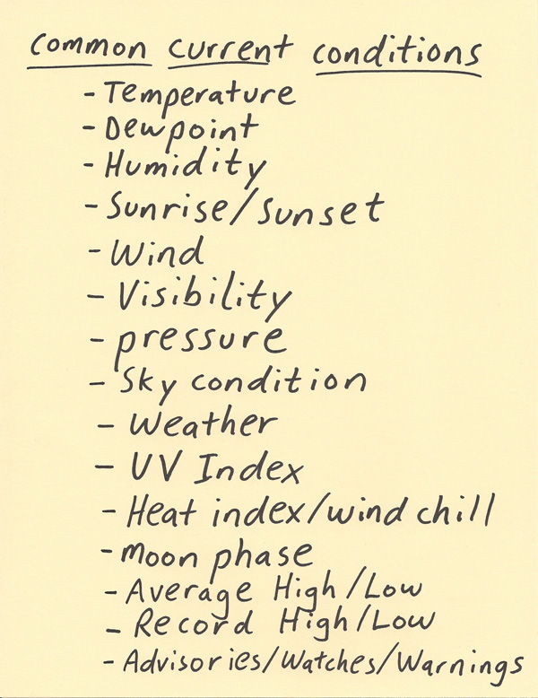 |