
One of the features of a storm that can cause severe weather is the storm wind called convective wind gusts. Convective wind from a storm that is 58 miles per hour (50 knots) or greater is considered severe. Winds at these speeds can produce considerable property damage and can danger life. To be considered a convective wind gust it must be produced by a convective storm. Typically these storms are thunderstorms but there are special cases where severe winds can blow out of non-thunder convection. 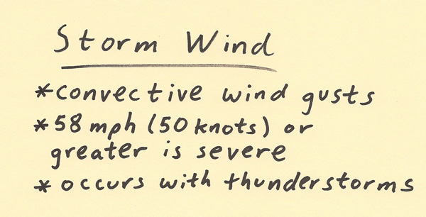 This next part of the mini-lecture will focus on how a convective wind gust is produced. A storm can bring strong upper level winds down to the surface. This is one way convective wind gusts can be produced. The process that can amplify the speed of upper level winds being brought down to the surface is the process of evaporation. When a downdraft of precipitation is forced through a layer of dry air then intense evaporative cooling will occur. This evaporation cools the air and makes the air denser. The precipitation within the downdraft also makes the downdraft denser than surrounding air. Since the air is now much denser, it will accelerate more quickly toward the earth’s surface. This negatively buoyant air accelerates to the surface, collides to the surface, and spreads out in all directions. An example to help visualize this process is to think of a water balloon hitting the ground the splashing in all directions. Since downdrafts often approach the earth’s surface at an angle, the greatest surface convective wind will tend to occur in a preferred direction. 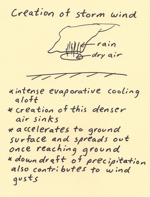 The angle that the downdraft hits the earth’s surface depends on the forward movement of the storm, the winds within the boundary layer and the angle the downdraft is moving to the surface. The downdraft winds tend to be more intense in the direction the storm is moving since the storm motion adds its movement to the speed of the downdraft. The winds within the boundary layer can preferentially force the downdraft at an angle toward the same direction the winds are within the boundary layer. The wind direction behind the downdraft can be much different than the winds surrounding the downdraft. The wind direction can shift as the storm moves through. The passing of the downdraft is very noticeable. The smell of the air can totally change. The wind direction and speed can totally change. The temperature and humidity of the air can totally change. This gust front can be a similar experience to a cold front passage. 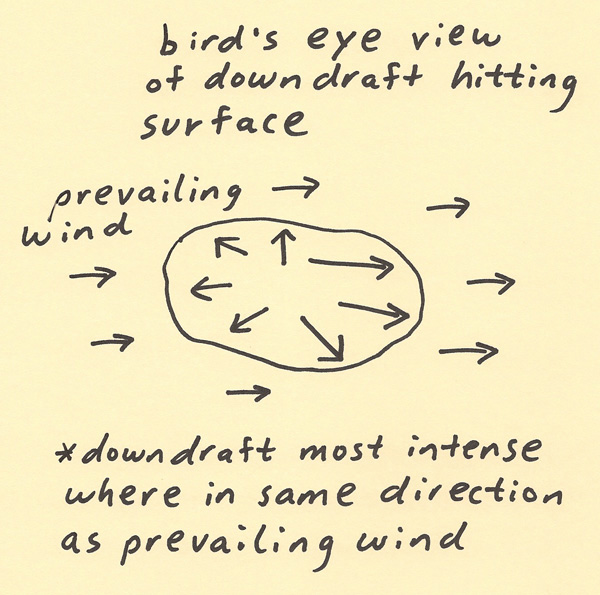
|