
A trough is a region of lower heights aloft (often analyzed at 500 and 300 mb). The troughs discussed here are the large size troughs that are associated with the jet stream. They can be large enough to cover part or most of the United States. The region of lower heights is created from the troposphere being relatively colder in temperature. Cold air is more dense and thus the height of the troposphere is less when the air is colder. Troughs have a significant impact on the weather. Generally cooler than normal weather will occur for the region under the influence of the trough (especially north and west of the trough axis). 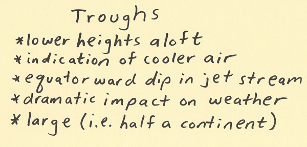 The diagram below is a sketch of a trough with its associated height contours. For scale purposes, imagine this trough covers ˝ of the United States. Also, this trough is at 500 millibars. Significantly different weather will occur on each side of the trough axis (the dashed line drawn through the center of the trough). The weather to the right of the trough axis (Box A) will experience lifting (due to positive vorticity advection, upper level divergence, and with the possible influx of low level moisture, low level warm air advection and instability release). The surface features below the right side of the trough at the earth’s surface is the region out ahead of the cold front and behind the warm front (thus in the warm sector). The right side of the trough is where precipitation chances are enhanced, storms are most likely and where the air is most likely to be unstable. To the left of the trough axis (Box B) is the region, that on a surface chart, will be behind the surface cold front. Thus, the weather tends to have sinking air, clearing weather and stable conditions. This is the region of the trough where below normal temperatures are reflected all the way to the surface. Since a trough tends to migrate to the east, the region on the right side of the trough will be on the left side of the trough in the next day or so. Thus, a significant trough can bring in unstable and stormy weather followed soon by dry weather with temperatures below normal. 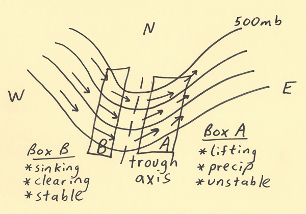 The last diagram shows the common wind directions that will take place at the surface (under the 500 mb trough). To the right of the trough, the surface winds will tend to have a southerly component (bringing up warmer and potentially more humid air at the surface) while to the left of the trough, the surface winds will tend to have a northerly component (bringing down colder and usually drier air). Thus, the troughs are carved out by cold air flowing to the south while the ridges are carved out by warm air flowing from the south. These large scale features help a weather forecaster predict future trends in the weather. 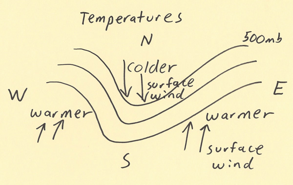 |