
Warm air advection and its counterpart cold air advection (both processes called thermal advection together) is one of the most fundamental aspects of analyzing and forecasting the weather by using analysis charts and model images. Warm air advection is the horizontal transport of warmer air into a point location. The most common places this occurs is behind a warm front and preceding a cold front. Warm air advection is best analyzed above the friction layer. Near the surface there are numerous contaminating influences to the thermal advection process such as warming from the earth’s surface, evaporation, wind direction shifts, vertical mixing of air and solar heating transport. Thus, the 850 level is great to use for locations near sea level and 700 mb is great to use for locations at higher elevations when analyzing thermal advection. When warm air advection occurs, warmer air will replace colder air. This increasing temperature change must occur due to a horizontal transport of air in order to be warm air advection. Processes such as condensational warming, adiabatic warming and radiative warming are not warm air advection. The diagram below shows the temperature contrast behind a warm front. In this case, the region behind the warm front is experiencing warm air advection. 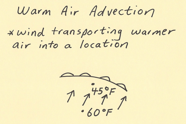 When using charts and models, weather analyzers and forecasters note the arrangement of 3 features which are height contours, isotherms, and the angle of intersection between height contours and isotherms. The diagram below has the definitions of several of these terms. The next diagram depicts an example of the warm air advection process. To maximize warm air advection it helps to have closely spaced height contours (indicates faster wind), closely spaced isotherms (indicates temperature will increase more quickly as warmer air moves in) and height contours and isotherms that are perpendicular to each other (maximizes transport of warmer air into a fixed point). To reduce warm air advection it helps to have widely spaced height contours (indicates slower wind), wider spaced isotherms (indicates temperature will increase slower as warmer air moves in) and height contours and isotherms that are parallel to each other (minimizes transport of warmer air into a fixed point). 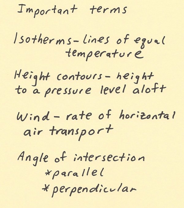 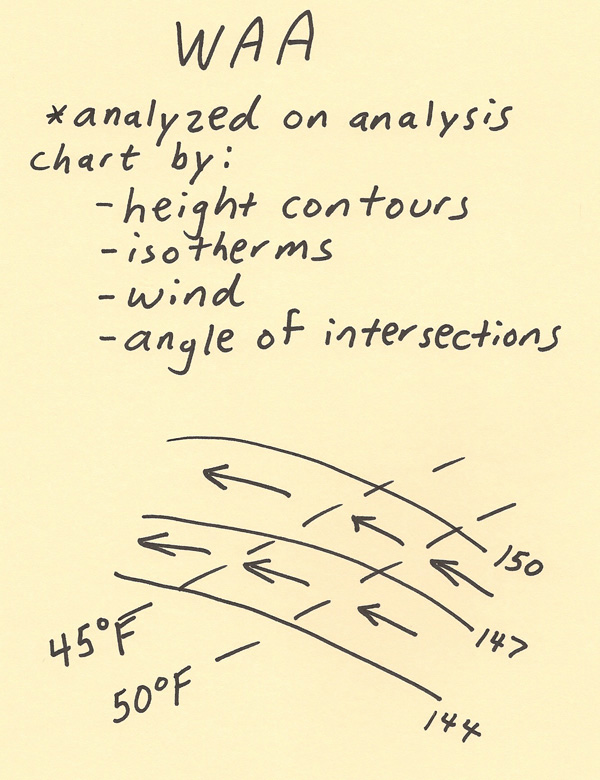 Warm air advection can have the following influences on weather: 1. Warm air advection sometimes brings in more humid air especially if the air is originating from warm ocean waters 2. Warm air advection is a lifting process thus this can increase precipitation chances and precipitation amounts 3. Weather will often be warmer than normal 4. It can indicate a big change in the weather, especially when significant |