
Significant surface features can be picked up using infrared and visible satellite imagery. This essay will focus on the meteorologically significant features. 1. Land vs. Water On visible imagery the water will usually appear darker than the land. This is because the water has a low albedo. What this means is that water is a very good absorber of solar radiation. Since visible imagery is sensing reflection, there will be less visible energy reflected off water and to the satellite. Lower reflective objects are darker and very reflective object are bright white on visible imagery. Below is a visible image showing the land-water reflection contrast. 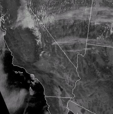 On infrared imagery the water could be darker or whiter than the land depending on the temperature. Colder objects are whiter on infrared imagery. If the water is colder than the land then the water will be whiter than the land. If the water is warmer than the land then the water will be darker than the land. Below is a contrast between the cooler Pacific Ocean waters and warmer USA land. 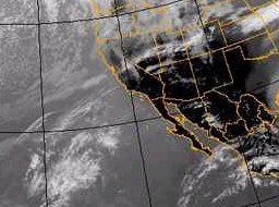 2. Snow Cover Snow cover will appear white on visible imagery. Snow cover on infrared looks like low clouds. You can tell the difference between clouds and snow cover on a clear day since snow cover does not move like clouds when put in motion and rivers and topographic features can be seen within the snow cover region. 3. Topographic features Satellite images allows the user to see all the unique topographic features on the surface including lakes, rivers, mountains, urban areas, farm lands, ocean currents, forests, oceans and hills. All these features are significant since they have an influence on the weather. These features will often initiate surface convergence boundaries (i.e. sea breeze, upslope flow and urban heat island). Lakes and Rivers: When the temperature difference is significant between land and water the lakes and rivers will show up very well on infrared imagery. Lakes and rivers will tend to be darker than the land on visible imagery. Mountains: They are best seen on visible imagery. The texture of the mountains can also be seen. 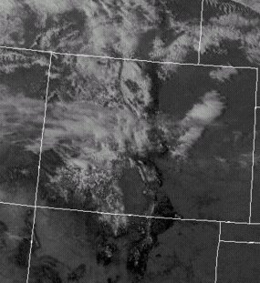 Urban areas: These are best seen on infrared imagery at night since the contrast between the warm urban areas and cooler rural areas has the greatest contrast. Ocean currents: The warm and cold ocean currents can be seen on infrared imagery. The cold ocean currents will be whiter and the warm ocean currents will be darker. 4. Fog Fog is a cloud on the ground. On visible, fog will look like low stratus. The thickness of the fog will determine how reflective it is. Dense fog will be bright white. Fog can be difficult to see on infrared since it is close to the same temperature as the ground. Good clues to fog being in place is that it can hide surface land features, during the day it tends to dissipate around the edges first, it does not move or at least not very quickly, and fog tends to have edges along topographic features. Fog can also be confined to valleys since cooler and more moist air can pool into the lower elevation regions. |